Walks you can reach from Baillieston by train

Lanarkshire · Scotland

Map

A day hike is just a simple train journey away — plan your next day of green.

Rutherglen
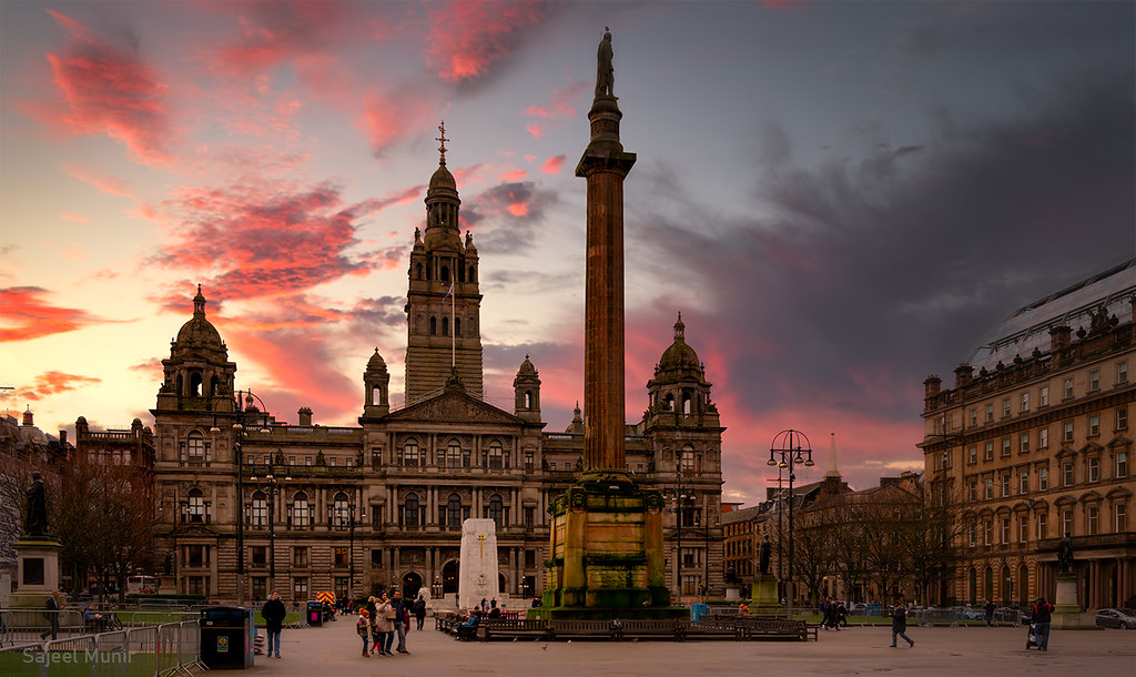
George Square, Glasgow by S Munir Photography

Rutherglen Station to East Kilbride Station (Lanarkshire)

8 minutes direct from Baillieston.

Walk details: Slow Ways.

GPX
Steep
10
KM
Motherwell
"Chatelherault" Ferniegair, Hamilton. Scotland by The Jacobite

Motherwell Station to Larkhall Station (Lanarkshire)

15 minutes direct from Baillieston.

Walk details: Slow Ways.

GPX
Rolling
14
KM
Glasgow Central
Glasgow Science Centre by Allan Ogg

Glasgow Central Station to Shettleston Station (Lanarkshire)

15 minutes direct from Baillieston.

A very direct, varied urban walk full of contrasts, mixing main roads, residential streets, high streets, footpaths, parks and greenspaces through old and new and upmarket and downmarket neighbourhoods. Some steps at the Shettleston end. Passes the Hovis factory and over the St Enoch subway station; intersects many bus routes.

Lunch: Many shops, cafés, takeaways and restaurants, especially around Glasgow Central and Argyle Street; a wide choice of eating around the halfway point near Duke Street, then options thin out until Shettleston.

Warnings: The wooded entrance to Greenfield Recreation Ground may feel daunting for solo walkers at quiet times. Some steps, including at Shettleston station.

Walk details: Slow Ways.

GPX
Rolling
8
KM
Glasgow Central
Glasgow - View from Queens Park by Edinbruhphotos

Glasgow Central Station to Bishopbriggs Station (Lanarkshire)

15 minutes direct from Baillieston.

A fairly direct urban route on pavements that climbs out of Bishopbriggs to Springburn Park, then drops through Springburn and follows the main road into central Glasgow and weaving cleverly through underpasses and flyovers around the M8 junction. Includes a number of steps. Connects Glasgow's two main railway stations and the bus station, passing George Square; Springburn station is also on the route.

Lunch: Shops and facilities at Springburn around the halfway point.

Warnings: A short stretch runs along the busy A803, and the footways negotiating the M8 junction can be fume-filled and tricky to navigate.

Walk details: Slow Ways.

GPX
Steep
8
KM
Stepps
Sunset Meets Geology 01 by byronv2

Stepps Station to Bargeddie Station (Lanarkshire)

3 minutes direct from Baillieston.

Walk details: Slow Ways.

GPX
Rolling
9
KM
Shettleston
Glasgow Cathedral Panorama by Christofer.Kelly

Shettleston Station to Bargeddie Station (Lanarkshire)

3 minutes direct from Baillieston.

A direct, mostly off-road route on paths and grass through parkland, with some single-track paths and stairs. A short and sometimes overgrown section near a petrol station at Mount Vernon.

Walk details: Slow Ways.

GPX
Rolling
8
KM
Busby
Linn Park Waterfall by billmac_sco

Busby Station to Rutherglen Station (Lanarkshire)

8 minutes direct from Baillieston.

striking views of the city, Campsie Hills and higher peaks beyond; excellent views to the south west with the peaks of Arran visible in the distance. A varied walk on mostly quiet roads, pavements and footpaths and climbing through farmland to the open paths and viewpoints of Cathkin Braes before descending through woodland (muddy in places) and parks into Rutherglen. Extensive woodland.

Warnings: The wooded descent from the country park to Tormusk Road can feel remote when walking alone; the final stretch crosses the busy Stonelaw Road. Can be muddy.

Walk details: Slow Ways.

GPX
Rolling
9
KM
Giffnock
Rouken Glen Boating Pond by Allan Ogg

Giffnock Station to Rutherglen Station (Renfrewshire)

8 minutes direct from Baillieston.

A mostly urban walk along fairly quiet residential streets, linking green spaces via core paths. The sections through Linn Park and King's Park are lovely with bird life and swathes of daffodils in spring. One long and straight final section is the least attractive part.

Walk details: Slow Ways.

GPX
Rolling
9
KM
Bargeddie
Drumpellier Loch by jmachoo

Bargeddie Station to Coatbridge Central Station (Lanarkshire)

3 minutes direct from Baillieston.

A route on paths and grass through woodland and parkland, including Luggie Glen Wood which is shielded from traffic noise and then through Summerlee Heritage Park beside the canal. Should be fine for wheels. Extensive woodland.

Walk details: Slow Ways.

GPX
Gentle
5
KM
Rutherglen
Linn Waterfall, Linn Park. Glasgow. Scotland by The Jacobite

Rutherglen Station to Shettleston Station (Lanarkshire)

8 minutes direct from Baillieston.

Walk details: Slow Ways.

GPX
Rolling
6
KM
Rutherglen
River Kelvin by Rollingstone1

Rutherglen Station to Cambuslang Station (Lanarkshire)

8 minutes direct from Baillieston.

A short, very straightforward walk following the main road between the two town centres, slightly uphill into Cambuslang. Noisy and not especially scenic and with many side roads to cross. The Clyde Walkway offers a longer, quieter alternative.

Warnings: Follows a busy main road with numerous side-road crossings.

Walk details: Slow Ways.

GPX
Rolling
3
KM
Motherwell
Roman Bridge by osedok

Motherwell Station to Wishaw Station (Lanarkshire)

15 minutes direct from Baillieston.

Walk details: Slow Ways.

GPX
Rolling
5
KM
More walks by train