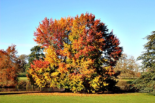
Walks near Woking by train
MapA day hike in the countryside is just a simple train journey away — explore the most charmingly located railway stations near Woking and plan your next day of green.
Alternatively, view walks directly from Woking.

Guildford Circular via Compton (Surrey)
7 minutes direct from Woking.
Beginner-friendly: No coast or river to follow, but pretty straightforward long lines nonetheless, and Watt’s Chapel provides a lovely reward for reaching the midpoint of the circuit. The lunch stop is a simple café in the vicinity of Watt’s Chapel, so no messing around with booking a table in advance.
Watts Chapel: A spectacular Arts and Crafts memorial chapel decorated by Mary Watts.
Time: 3h30–7h
1 lunch spot: Watts Gallery café (1h30–3h in)
5 end-of-walk rewards: the Withies Inn, Ye Olde Ship Inn, the Britannia, the White House, or the George Abbot
Adapted from: The Rough Guide to Walks in London & the South East (3rd edition).
Similar walk: Walking Post (inc. GPX).

Salisbury Circular via Stonehenge (Wiltshire)
1 hour direct from Woking.
Highly recommended
Time: 4h30–9h
1 lunch spot: the Bridge Inn (2h30–5h30 in; excellent)
Warnings: Have lunch a café or pub next to the river. Return from Stonehenge to Salisbury by bus (very frequent & reliable but check times).
Adapted from: The Rough Guide to Walks in London & the South East (3rd edition).

Gomshall Circular via Shere (Surrey)
30 minutes from Woking, with one change.
Highly recommended: Extensive woodland.
Woodland: two fifths under tree cover.
Saint James's Church: see the remains of where a devout anchorite was encased within the church walls.
Time: 3h–6h
7 lunch spots: Shere (1h–1h30 in) — the Dabbling Duck Café (excellent), the William Bray, Hillys Tea Shop, or the White Horse; plus the Drummond Arms (1h–2h in), Mandira's Kitchen at Silent Pool (1h–2h30 in), or Carb Up and Go (1h30–3h30 in)
2 end-of-walk rewards: the Compasses Inn, or the Gomshall Mill
Warnings: Can be muddy.
Adapted from: The Rough Guide to Walks in London & the South East (3rd edition).

Farnham to Blackwater (Surrey)
30 minutes direct from Woking.
Highly recommended: Deer park, heathland, MOD training area, Iron Age hillfort, reservoirs, stream valleys, woodland, nature reserve, wet meadows, lakeside sandy shores and common.
Woodland: a third under tree cover.
Time: 5h30–11h
1 lunch spot: the Foresters (2h30–4h30 in)
1 end-of-walk reward: the Crown and Cushion
Warnings: MOD closures apply.
Source: Trains2Green.
Similar walk: the Saturday Walkers Club.

Farnham to Godalming (Surrey)
30 minutes direct from Woking.
Highly recommended: River valley, forest tracks, sandy bridleways, open parkland, country houses and wooded valleys.
Woodland: a third under tree cover.
Mother Ludlam's Cave: Sandstone cave associated with local folklore.
Time: 6h–12h
1 lunch spot: the Barley Mow, Tilford Green (2h30–4h30 in)
5 end-of-walk rewards: the Cyder House Inn, the Rose and Crown, the Richmond Arms, the Fox & Finch, or the Star
Warnings: Can be muddy.
Adapted from: Time Out Country Walks Volume 1.
Similar walks: the Saturday Walkers Club and Slow Ways (inc. GPX).

Bentley to Farnham (Hampshire)
30 minutes direct from Woking.
Highly recommended: Ancient forests, heathland ridges, Scots pine, heather, large ponds with swimming, remote commons and quiet woodland paths and lanes.
Woodland: half under tree cover.
The Devil's Jumps
Time: 6h30–13h30
1 lunch spot: the Bel & The Dragon (3h30–6h30 in)
Warnings: MOD closures apply.
Source: Trains2Green.
Similar walk: the Saturday Walkers Club.
Reverse direction: Blackwater Valley Nature Walks.

Milford to Haslemere (Surrey)
30 minutes from Woking, with one change.
Highly recommended: Remote heathland, pretty lakes, sandy bridleways, ancient woodland, heather and gorse commons and a dramatic natural amphitheatre.
Woodland: a third under tree cover.
Time: 4h30–9h30
Lunch: Nowhere to eat en route — pack lunch!
1 end-of-walk reward: the Harper's Steakhouse
Warnings: Can be muddy.
Adapted from: Time Out Country Walks Volume 1.
Similar walk: the Saturday Walkers Club.

Mortimer to Bramley (Berkshire)
45 minutes from Woking, with one change.
Highly recommended: Little known but quietly wonderful. Beautiful rather than spectacular, in a humble English village pathways sort of manner. Mostly secluded.
Remnants of Calleva Atrebatum: includes ruins ofthe original walls, and a large amphitheatre where gladiatorial combats entertained up to 7,000 people at a time.
St Mary the Virgin Church: on the site of a Roman temple.
Time: 3h30–6h30
1 lunch spot: the Calleva Arms (1h30–3h30 in; excellent)
1 end-of-walk reward: the Bramley Inn
Adapted from: The Rough Guide to Walks in London & the South East (3rd edition).
Similar walk: Reading to Basingstoke Community Rail Partnership.

Woldingham to Oxted (Surrey)
1 hour from Woking, with one change.
Highly recommended: North Downs woodland ridge, open chalk downland, M25 crossing, village green, Greensand Way farmland, small settlements and ancient churchyards.
Woodland: a quarter under tree cover.
Time: 4h–7h30
4 lunch spots: Godstone (2h–4h in) — the Hare & Hounds, the Old Forge Deli, the White Hart, or the Bell
1 end-of-walk reward: the Oxted Inn
Warnings: Chalk paths can be slippery.
Source: Trains2Green.
Similar walk: the Saturday Walkers Club.

Haslemere Circular via Black Down (Surrey)
30 minutes direct from Woking.
Mixed National Trust woodland, heathland with bracken, gorse, heather and bilberry, hilltop plateau, open views, rhododendron tunnels and undulating bridleways.
Time: 4h30
Warnings: Can be muddy.
Walk details: the Saturday Walkers Club (tips, local insights and turn-by-turn directions).

Alton Circular via Windmill Hill (Hampshire)
45 minutes direct from Woking.
An 11-mile ramble over the six hills ringing Alton, with farmland, woodland near Monk Wood, the River Wey and the Hangers Way, gateway to the South Downs.
Warnings: Includes a subway crossing under the A31 and field-edge paths that may be muddy.
Walk details: Wey Valley Community Rail Partnership (PDF).
Bramley Circular via Calleva Atrebatum (Hampshire)
30 minutes from Woking, with one change.
Mostly flat farmland, Bramley Frith Wood and the Roman walls of Calleva Atrebatum at Silchester, with a 12th-century church and a stretch of the Camino Ingles pilgrim route.
Calleva Atrebatum: The remains of the Roman town of Calleva Atrebatum, with substantial surviving flint walls and an amphitheatre.
St Mary the Virgin Church: on the site of a Roman temple.
Time: 3h
Walk details: Reading to Basingstoke Community Rail Partnership (turn-by-turn directions).