Walks near Swindon by train
Wiltshire · South West England
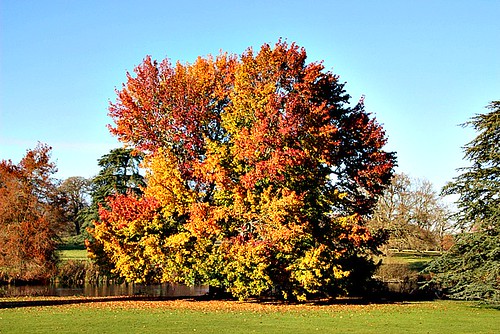
MapA day hike in the countryside is just a simple train journey away — explore the most charmingly located railway stations near Swindon and plan your next day of green.

Hanborough Circular via Blenheim Palace (Oxfordshire)
45 minutes from Swindon, with one change.
Beginner-friendly: A gigantic well-signposted park. It’s completely fine to deviate from the route — explore as you like! Plenty of options for lunch — no need to reserve a table. It's an easy walk from the station to the beautiful, vast (and free) grounds of the finest example of English baroque architecture. For a somewhat extortionate fee you can also visit the house, but you'd probably want a whole day for that.
Woodland: a quarter under tree cover.
Time: 3h30–7h
3 lunch spots: Woodstock (1h30–3h in) — the Crown, the Back Lane Tavern, or the Star Inn
1 end-of-walk reward: the George and Dragon
Adapted from: The Rough Guide to Walks in London & the South East (3rd edition).

Mortimer to Bramley (Berkshire)
45 minutes from Swindon, with one change.
Highly recommended: Little known but quietly wonderful. Beautiful rather than spectacular, in a humble English village pathways sort of manner. Mostly secluded.
Remnants of Calleva Atrebatum: includes ruins ofthe original walls, and a large amphitheatre where gladiatorial combats entertained up to 7,000 people at a time.
St Mary the Virgin Church: on the site of a Roman temple.
Time: 3h30–6h30
1 lunch spot: the Calleva Arms (1h30–3h30 in; excellent)
1 end-of-walk reward: the Bramley Inn
Adapted from: The Rough Guide to Walks in London & the South East (3rd edition).
Similar walk: Reading to Basingstoke Community Rail Partnership.

Henley-on-Thames to Pangbourne (Oxfordshire)
30 minutes from Swindon, with one change.
Highly recommended: Thames riverside, ancient streets, broad valleys, beech woods, fields, small villages, alpaca farm and toll bridge.
Woodland: two fifths under tree cover.
Time: 5h–10h30
1 lunch spot: the Red Lion (1h30–3h30 in)
1 end-of-walk reward: the Greyhound
Warnings: Can be muddy.
Adapted from: Time Out Country Walks Volume 1.
Similar walk: the Saturday Walkers Club.

Farnham to Blackwater (Surrey)
45 minutes from Swindon, with one change.
Highly recommended: Deer park, heathland, MOD training area, Iron Age hillfort, reservoirs, stream valleys, woodland, nature reserve, wet meadows, lakeside sandy shores and common.
Woodland: a third under tree cover.
Time: 5h30–11h
1 lunch spot: the Foresters (2h30–4h30 in)
1 end-of-walk reward: the Crown and Cushion
Warnings: MOD closures apply.
Source: Trains2Green.
Similar walk: the Saturday Walkers Club.

Pangbourne to Goring & Streatley (Berkshire)
30 minutes from Swindon, with one change.
Highly recommended: Woods, hilly, river and quaint village.
Woodland: a third under tree cover.
Time: 3h30–7h
3 lunch spots: Streatley (2h–4h in) — Pierreponts, or the Swan at Streatley and the Coppa Club; plus the Bull (2h–4h in)
2 end-of-walk rewards: the Miller of Mansfield, or the Catherine Wheel
Warnings: Relatively busy.
Source: Trains2Green.

Bath Spa Circular via Dundas Aqueduct (Somerset)
30 minutes direct from Swindon.
Disused railway path, tunnels, viaducts, canal towpath, river and historic city centre.
Walk details: the Saturday Walkers Club (tips, local insights and turn-by-turn directions).

Goring & Streatley Circular via Aldworth (Oxfordshire)
30 minutes from Swindon, with one change.
Undulating downs, Thames-side views, Ridgeway path, chalk hills and quaint villages.
Time: 5h30
Warnings: Steep descents.
Walk details: the Saturday Walkers Club (tips, local insights and turn-by-turn directions).

Pangbourne Circular via Goring (Berkshire)
30 minutes from Swindon, with one change.
Part-wooded ridges, open pastures, wildflower nature reserve, Thames river meadows, beech woods and Thames-side villages.
Time: 4h
Warnings: Can be muddy.
Walk details: the Saturday Walkers Club (tips, local insights and turn-by-turn directions).

Mortimer Circular via Remnants of Calleva Atrebatum (Berkshire)
45 minutes from Swindon, with one change.
Long, mostly flat circular: the Calleva Atrebatum Roman amphitheatre and walls, Pamber Forest Reserve and farmland around Mortimer, Silchester and Bramley.
Remnants of Calleva Atrebatum: includes ruins ofthe original walls, and a large amphitheatre where gladiatorial combats entertained up to 7,000 people at a time.
Calleva Atrebatum: The remains of the Roman town of Calleva Atrebatum, with substantial surviving flint walls and an amphitheatre.
Time: 5h30
Walk details: Reading to Basingstoke Community Rail Partnership (turn-by-turn directions).
Bramley Circular via Calleva Atrebatum (Hampshire)
45 minutes from Swindon, with one change.
Mostly flat farmland, Bramley Frith Wood and the Roman walls of Calleva Atrebatum at Silchester, with a 12th-century church and a stretch of the Camino Ingles pilgrim route.
Calleva Atrebatum: The remains of the Roman town of Calleva Atrebatum, with substantial surviving flint walls and an amphitheatre.
St Mary the Virgin Church: on the site of a Roman temple.
Time: 3h
Walk details: Reading to Basingstoke Community Rail Partnership (turn-by-turn directions).

Reading to Henley-on-Thames (Berkshire)
30 minutes direct from Swindon.
Flat Thames towpath, riverside parks, wooded sections, pasture fields, meadows and riverside gardens.
Waterway: four fifths along the River Thames.
Time: 4h–8h
Warnings: Flood risk sections.
Walk details: the Saturday Walkers Club (tips, local insights and turn-by-turn directions).

Reading to Shiplake (Berkshire)
30 minutes direct from Swindon.
Flat Thames Path riverside countryside, the Horseshoe Bridge and the historic Bull Inn at Sonning (of Three Men in a Boat).
The River Thames: England's best-known river, whose towpath (the Thames Path National Trail) carries long stretches of nearly every walk in this set.
Time: 2h30
Warnings: Shared with cyclists between Reading and Sonning; walkers only beyond.
Walk details: Reading to Basingstoke Community Rail Partnership (turn-by-turn directions).