Walks you can reach from Plumstead by train
MapA day hike is just a simple train journey away — plan your next day of green.

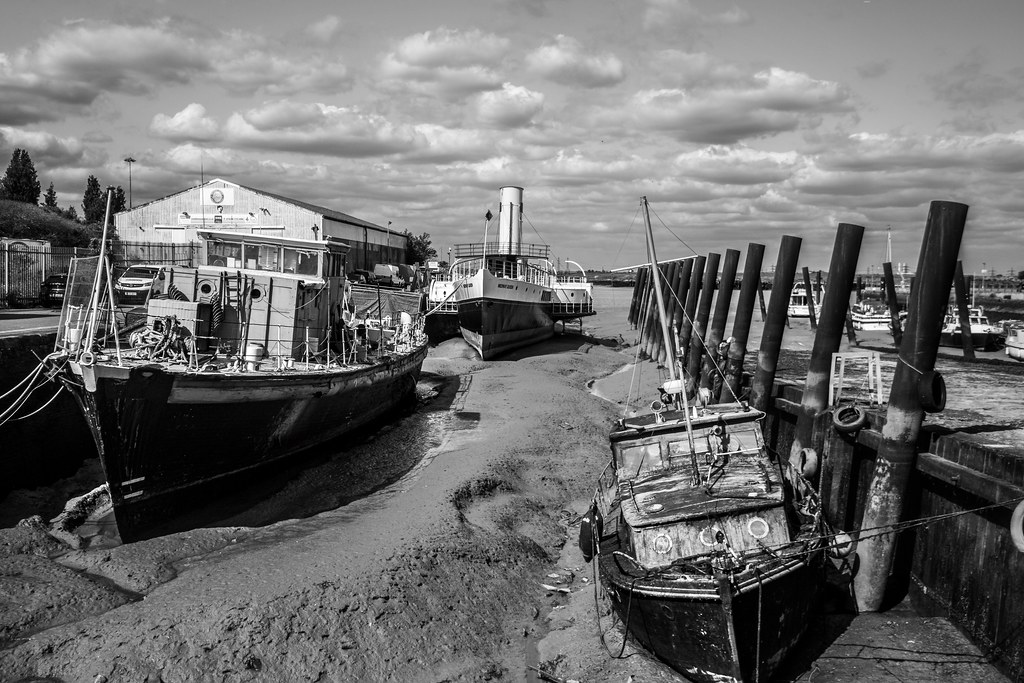
Dartford Circular via Dartford Marshes (Kent)
15 minutes direct from Plumstead.
Circular around Dartford Marshes beside the meandering River Darent towards the Thames, with wading birds and the ruins of the Wells fireworks factory.
Walk details: Kent Downs National Landscape (tips, photos and local insights).

London Bridge Circular (Surrey)
30 minutes direct from Plumstead.
A walk through London's history around the square mile, past the Tower of London, St Paul's Cathedral and the Guildhall.
Time: 2h30–5h
Warnings: Two thirds urban. Several sets of steps, cobbled streets and narrow alleys.
Walk details: Walking Post (tips, photos and local insights).

Blackheath to Canary Wharf (Kent)
15 minutes direct from Plumstead.
Leafy Georgian avenues, open heath, parkland, Royal Observatory hill, riverside Thames Path, Docklands waterfront and financial district.
Time: 2h30
Walk details: the Saturday Walkers Club (tips, local insights and turn-by-turn directions).

Blackheath to Deptford (Kent)
15 minutes direct from Plumstead.
Urban London, genteel residential streets, Georgian and Victorian estates, large open heathland, well-kept parks, river valleys, Victorian cemeteries and green hilltops with panoramic city views.
Time: 5h
Walk details: the Saturday Walkers Club (tips, local insights and turn-by-turn directions).

Dartford to Greenhithe (Kent)
15 minutes direct from Plumstead.
Flat riverside paths, flood defences, marshland, industrial edge-land and wide Thames estuary views.
Time: 1h30–3h
Warnings: Follows a busy road for a fifth of the walk. Flood risk — check warnings.
Walk details: the Saturday Walkers Club (tips, local insights and turn-by-turn directions).

Higham to Gravesend (Kent)
45 minutes direct from Plumstead.
Flat estuary landscape, gravel tracks, grassy paths, marshes, open water, mud flats, RSPB reserve, industrial heritage and big skies.
Warnings: Can be muddy.
Walk details: the Saturday Walkers Club (tips, local insights and turn-by-turn directions).

Rochester to Sole Street (Kent)
45 minutes direct from Plumstead.
Dickensian Kent and the Medway: Rochester's cathedral and castle, then Ranscombe Farm and Cobham Park to Sole Street.
Woodland: a fifth under tree cover.
The Rochester Cathedral: England's second-oldest cathedral, founded in 604, in the heart of Rochester.
The Rochester Castle: A Norman castle beside the Medway with one of the tallest surviving keeps in England.
The Ranscombe Farm Reserve: A nature reserve near Rochester protecting rare arable wildflowers on the Kent downs.
The Cobham Park: A landscaped Repton parkland surrounding Cobham Hall, with the Darnley Mausoleum.
Time: 3h30–7h
Walk details: Walking Post (tips, photos and local insights).

Gravesend to Sole Street (Kent)
30 minutes direct from Plumstead.
Recommended: A route of two halves: a quiet way through Gravesend on residential streets, small parks and a green lane, then around 70% off-road through wide open fields and woodland and small lanes towards Sole Street. Easy-going paths; a steep lane in places. Around 70% off-road overall. Almost follows the Weald Way long-distance route between the petrol station and Sole Street. Passes alongside the Cyclopark, a linear country park. Bluebells in the small woodlands in season.
Time: 2h30–5h
Lunch: A Morrisons with a cafe and toilets at the edge of Gravesend, plus a small petrol station; a pub and a tiny shop at Sole Street.
Warnings: White Post Lane requires a 20m stretch of road walking; take care.
Walk details: Slow Ways.

Rochester to Maidstone East (Kent)
45 minutes direct from Plumstead.
Recommended: Gorgeous. A gorgeous, very off-road and quiet route following the River Medway along the Medway Valley Walk, then the North Downs Way and the Augustine Camino before rejoining the river. Well signed throughout and with only a few short bits crossing or going under motorways. Follows the Medway Valley Walk, the North Downs Way and the Augustine Camino. No public transport in the central section, though Aylesford station is about a mile from the village.
Time: 5h–10h30
Walk details: Slow Ways.
Gillingham to Sittingbourne (Kent)
1 hour direct from Plumstead.
Recommended: Lovely views out over the marshes. A lovely, varied route through woods, fields, gentle hills, orchards and a river estuary, with small sections of mostly safe road walking. The first half is farmland over very gentle hills; the second follows the Medway estuary on the England Coast Trail, with lovely views over the marshes and mudflats. Quite a lot of tarmac and with some muddy parts and slanted cycle gates. The estuary section is on the England Coast Trail. Optional detour along a causeway to 'Horrid Hill'. Break points at Borden, Newington, Rainham, Riverside Country Park and the Strand leisure area.
Time: 5h30–11h
Lunch: Break points with pubs/shops at Borden, Newington and Rainham; cafes and toilets at Riverside Country Park and the Strand.
Warnings: Steps, stiles and gates throughout, plus slanted cycle gates along the estuary. A field path beyond Newington was not reinstated across crops. Care crossing main roads.
Walk details: Slow Ways.

Gillingham to Rainham (Kent)
1 hour direct from Plumstead.

Gillingham to Queenborough (Kent)
1 hour direct from Plumstead.
Recommended: The close up views of salt marshes and mud flats of the Medway and Swale, made all the more atmospheric by the distant industrial structures. A long, three-part coastal and estuary route: first a wide, popular path right by the Medway estuary coastline with great views; then field paths and quiet lanes on higher ground with views inland and across the estuary; finally a freshly opened section of the England Coast Path on the Isle of Sheppey. Some informal/permissive paths, deep ruts hidden under long grass and possible high-tide flooding. Uses the England Coast Path. Salt marshes and mudflats are important nesting sites for coastal birds and rare plants. Can be broken at Rainham, Lower Halstow, Iwade or Swale station; the Sheppey line has five stations.
Coastal: three quarters along the coast.
Time: 6h30–13h
Lunch: Toilets and cafes at the Strand in Gillingham and in Riverside Country Park; pubs on Lower Rainham Road; pubs and shops at Lower Halstow and Iwade.
Warnings: The England Coast Path section on Sheppey had unfinished waymarkers and crosses ground with deep ruts hidden under long grass. Some high-tide saltmarsh paths may flood.
Walk details: Slow Ways.